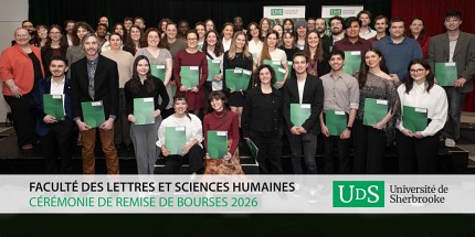
Professeur et chercheur membre du Cartel
 Jérôme
Théau
Professeur adjoint
Département de géomatique appliquée
Faculté des lettres et sciences humaines
Université de Sherbrooke
Sherbrooke (Québec)
J1K 2R1
Téléphone : 819-821-8000 poste 62195
Télécopieur : 819-821-7944
Courriel :Jerome.Theau@USherbrooke.ca
Local : A6-2011
Diplômes et formation
- Diplôme Universitaire de Technologie, Institut
Universitaire de Technologie, Caen, France (1995)
- B.
Sc. Université de Sherbrooke, Canada (1996)
- M. Sc. Université du
Québec à Rimouski, Canada (1999)
- Ph. D. Université Laval, Canada
(2004)
- Postdoctorat, Idaho State University, Pocatello,
États-Unis
- Postdoctorat, Maison de la télédétection,
Montpellier, France
Profil d'enseignement
- Écotourisme, parcs, ressources et géomatique (GAE 700)
- Géomatique et développement durable (GMQ 703)
Profil de recherche
Systèmes d’Information Géographique
- analyses spatiales
- modélisation d’habitats
Télédétection
- traitement d’images
- détection de changements
Caractérisation des habitats fauniques
- Distribution et disponibilité des ressources
- Qualité des habitats et indicateurs environnementaux
- Effets des pratiques de gestion sur l’état des écosystèmes
Étude de la fragmentation du paysage
- Cartographie des réseaux et corridors écologiques
- Aspects méthodologiques et effets d’échelle
- Impacts des infrastructures et activités humaines
- Évaluation de l’efficacité des réseaux d’aires protégées
Projets en cours
- Caractérisation de la disponibilité et de l’abondance des
ressources dans les habitats fauniques en milieu semi-aride
Collaborateurs : Keith T. Weber, Temuulen, T. Sankey, Idaho
State University
- Réseaux et corridors écologiques: Bilan méthodologique et
cartographie test d’un réseau écologique national francais
Collaborateur : Michel Deshayes, Cemagref et Maison de la
Télédétection
Publications récentes (avec comité de lecture)
Weber K., Théau J. et K. Serr (2008) Effect of Coregistration
Error on Patchy Target Detection using High-Resolution Imagery.
Remote Sensing of Environment 112: 845-850.
Théau J. (2008)
Change Detection. Encyclopedia of Geographical Sciences. Ed:
Shashi Shekhar and Hui Xiong, Springer, New-York, 77-84.
Théau
J., Peddle D. et C. Duguay (2005) Mapping Caribou Lichen Habitat
in Northern Quebec, Canada, using an Enhancement-Classification
Method and Spectral Mixture Analysis. Remote Sensing of
Environment 94 : 232-243.
Théau J. et C. Duguay (2004) Mapping
Lichen Habitat Changes inside the Summer Range of the George
River Caribou Herd (Québec-Labrador, Canada) using Landsat
Imagery (1976-1998). Rangifer. 24: 31-50.
Théau J. et C. Duguay
(2004) Lichen mapping in the summer range of the George River
Caribou Herd (Northern Québec-Labrador, Canada) using Landsat TM
imagery. Canadian Journal of Remote Sensing. 30 : 867-881.
Autres publications récentes (rapports, documents de
vulgarisation etc.)
Côté, M. Hébert B. Théau J. et S. Fortin (2007) Stratégie de
transfert de connaissances du Consortium en foresterie
Gaspésie-Les-Îles - 1ère mise à jour. Consortium en Foresterie
Gaspésie-Les-Îles, Gaspé, Canada, 38 p.
Théau J. Côté M. et S.
Fortin (2005) Plan de développement des Produits Forestiers Non
Ligneux en Gaspésie. Consortium pour le développement durable de
la forêt gaspésienne – Pour le compte de la Conférence régionale
des Élu(e)s Gaspésie-les-Îles. 10 p.
Côté M. Théau J. et S.
Fortin (2005) Plan de transfert de connaissances du Consortium
en foresterie Gaspésie-Les-Îles. Consortium en Foresterie
Gaspésie-Les-Îles, Gaspé, Canada, 14 p. (élaboration de la
stratégie et des mécanismes de transfert).
Côté M. Théau J. et
S. Fortin (2004) Bilan forestier régional, basé sur les
connaissances – Gaspésie-Îles-de-la-Madeleine. Consortium pour
le développement durable de la forêt gaspésienne, Gaspé, Québec,
Canada, 189 p.
Communications récentes à des congrès et colloques
Tibbitts, Weber, Sankey et Théau (2008) Rangeland
Sustainability Modeling Using Soil Exposure and Soil Moisture
Parameters. Joint Meeting of the International Grassland
Congress and the International Rangeland Congress, Hohhot,
Chine.
Théau, Sankey, Weber, Ahmed et Tibbitts (2008) Effect of
Spatial Resolution on Remotely-Sensed Rangeland Vegetation
Indices. Joint Meeting of the International Grassland Congress
and the International Rangeland Congress, Hohhot, Chine.
Théau,
Weber et Serr (2008) Coregistration error between imagery and
field data: a limiting factor for the detection of patchy
targets in rangelands. Joint Meeting of the Society for Range
Management and the American Forage and Grassland Council,
Louisville, Kentucky, USA.
Théau, Sankey, Weber, Ahmed et
Tibbitts (2008) Cross-Scale Comparison of Common Vegetation
Indices in A Semi-Arid Environment. Joint Meeting of the Society
for Range Management and the American Forage and Grassland
Council, Louisville, Kentucky, USA.
Tibbitts, Théau, Glenn et
Weber (2007) The use of remote sensing and GIS to model
rangeland health characteristics. Environmental Sensing
Symposium, Boise State University, Boise, Idaho USA.
Serr, Weber
et Théau (2007) Effect of Coregistration Error on Patchy Target
Detection using High-Resolution Imagery. Intermountain GIS
Conference 2007, Donnely, Idaho, USA.
Théau, Tibbitts, Weber, et
Sankey (2007) Rangeland health modeling using remote sensing and
GIS in southeastern Idaho. 60th Annual Meeting of the Society
for Range Management. Reno, Nevada, USA.
Théau et Weber (2006)
Forecasting Rangeland Condition with GIS in Southeastern Idaho.
Joint Workshop on NASA Biodiversity, Terrestrial Ecology, and
Related Applied Sciences. University of Maryland, Adelphi, USA.
Théau (2006) Detection of changes using remote sensing: an
overview of principles and applications. Geo-Spatial and Range
Sciences Conference, Idaho State University, Pocatello, USA.
Théau et Duguay (2003) Spatio-temporal mapping of lichen
habitats using Landsat imagery: A tool for caribou herd
management in northern Québec, Canada. 11th Arctic Ungulate
Conference, Saariselkä, Finlande.
Théau, Peddle et Duguay (2003)
Enhancement-Classification and Spectral Mixture Analysis of
Caribou Lichen Habitats, Northern Québec, Canada. IEEE
International Geoscience and Remote Sensing Symposium, Toulouse,
France.
Théau et Duguay (2003) Mapping lichen in the caribou
summer range of northern Quebec, Canada, using Landsat TM
imagery. 33rd Annual Arctic Workshop, Polar Environmental
Centre, Tromsø, Norvège.
Théau et Duguay (2002). L'utilisation
de la télédétection pour l'étude des grands mammifères illustrée
par un projet sur le troupeau de caribous de la rivière George.
Association Francophone pour le Savoir, Université Laval,
Québec, Canada. |